
Introduction
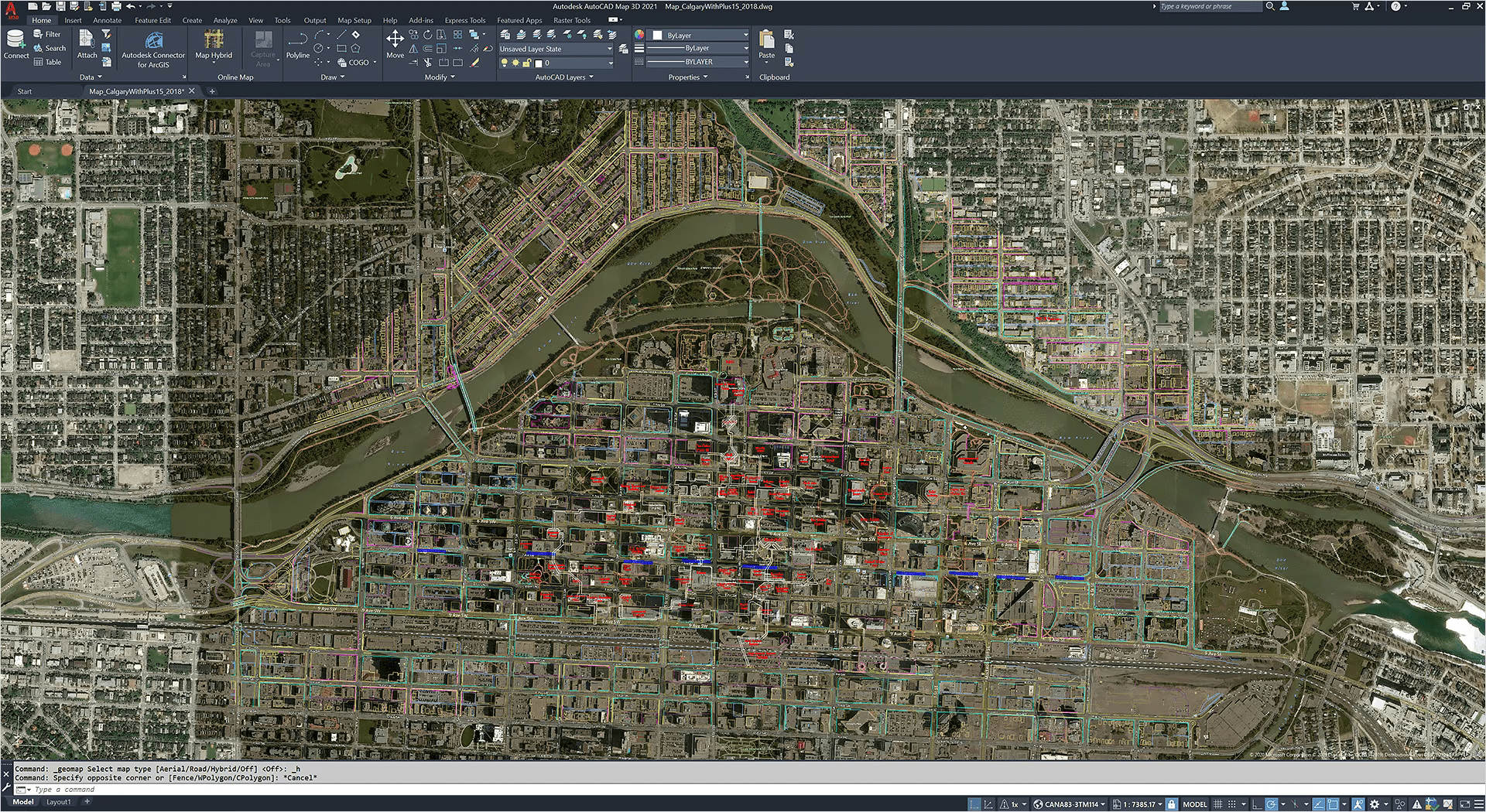
Autodesk AutoCAD Map 3D is a geographic information system (GIS) software application developed by Autodesk. It is designed to help professionals manage, analyze, and visualize geospatial data. Here’s a brief introduction to its key features and functions:
Key Features:
- Data Management:
- Integration with GIS Data: Import, visualize, and manage GIS data from various sources. AutoCAD Map 3D supports a wide range of formats including SHP, KML, and DWG.
- Database Connectivity: Connect to spatial databases like Oracle, SQL Server, and PostgreSQL, enabling users to work with large datasets and perform complex queries.
- Mapping and Visualization:
- Customizable Maps: Create detailed and customizable maps with layers, labels, and symbology. Users can modify map styles to suit their needs.
- Coordinate Systems: Support for a wide range of coordinate systems and projections, allowing users to accurately represent geographic data.
- Data Analysis:
- Spatial Analysis Tools: Perform spatial queries, buffering, and overlay analysis to extract valuable insights from geospatial data.
- Geoprocessing: Execute complex geoprocessing tasks to manipulate and analyze spatial data.
- Integration with AutoCAD:
- AutoCAD Compatibility: Seamless integration with AutoCAD, allowing users to leverage familiar drafting tools and workflows within a GIS environment.
- Data Sharing: Easily share and collaborate on GIS projects with others using AutoCAD DWG files.
- Customization and Automation:
- Customization Tools: Create custom tools and workflows using AutoLISP, .NET, or VBA to automate repetitive tasks and enhance productivity.
- Data Import/Export: Efficiently import and export geospatial data to and from different formats and databases.
- Map Production:
- Map Layouts: Design professional-quality map layouts for printing and presentation, including legends, scales, and titles.
Use Cases:
- Urban Planning: Assist city planners with land use planning, infrastructure management, and zoning analysis.
- Utilities Management: Manage and analyze utility networks, including water, sewer, and electrical systems.
- Environmental Analysis: Perform environmental impact assessments and manage natural resources.
Getting Started:
To get started with AutoCAD Map 3D, you might consider:
- Training and Tutorials: Autodesk provides a range of tutorials and training resources to help users learn the software.
- Documentation: Refer to the official Autodesk documentation for detailed guidance on specific features and functions.
AutoCAD Map 3D is a powerful tool for professionals who need to manage and analyze geographic and spatial data, offering a range of capabilities to support complex geospatial projects.
Details
Latest version
2025
2025
Developer
Autodesk
Autodesk
Updated on
August 10, 2024
August 10, 2024
License
Paid
Paid
Advertisement
No ads
No ads
OS System
Windows
Windows
Language
Multilanguage
Multilanguage
Downloads
522
522
Rating
__
__
Website
__
__
Download
Autodesk AutoCAD Map 3D
3.85 GB 2025
Decompression password: 123 or hisofts.net
Broken or outdated link? report
Similar Software

Nemetschek Allplan 2024.1.2
6.02 GB

SketchBook Pro 8.8.36.0
63.7 MB
Autodesk ReCap Pro 2024
1.65 GB
Siemens Simcenter Amesim 2404
14.4 GB
Autocom 2.17.01.03
6.0 GB

Sweet Home 3D 7.4
272 MB
V-Ray Next 6.00.03 for Maya
495 MB