Introduction
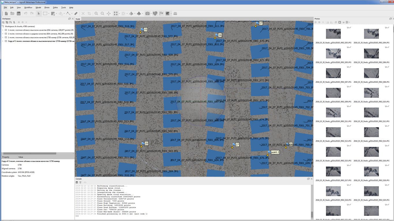
Agisoft Metashape Professional, now known as Metashape, is a powerful photogrammetry software used primarily for generating 3D spatial data from 2D images. Here’s a detailed introduction to its features and capabilities:
Overview:
Agisoft Metashape allows users to create 3D models and maps from photographs. It processes digital images taken from different angles to produce accurate point clouds, textured polygonal models, orthomosaics, and digital elevation models (DEMs). It is widely used in fields such as archaeology, geology, forestry, and cultural heritage documentation.
Key Features:
- Photogrammetric Processing:
- Alignment: Automatically aligns photos based on identifiable features.
- Sparse Point Cloud: Generates sparse point clouds from the aligned photos.
- Dense Point Cloud: Calculates dense point clouds with high precision.
- Mesh Generation:
- Polygonal Mesh: Creates 3D polygonal models from dense point clouds.
- Texture Mapping: Applies textures from photos to the 3D models for realistic visualization.
- Digital Elevation Model (DEM) and Orthomosaic Generation:
- DEM: Produces accurate elevation models from the point clouds.
- Orthomosaic: Generates georeferenced orthomosaics (maps) from overlapping images.
- Georeferencing:
- GPS Support: Integrates GPS data for accurate geolocation of models and maps.
- Coordinate System Support: Enables alignment and export in various coordinate systems.
- Processing Tools:
- Batch Processing: Automates workflows for large datasets.
- Scripting: Allows customization and automation of processes via Python scripts.
- Export and Integration:
- Export Formats: Supports standard formats for 3D models (OBJ, PLY), maps (GeoTIFF, KML), and reports (PDF, HTML).
- Integration: Interfaces with GIS (Geographic Information Systems) and CAD (Computer-Aided Design) software.
- Advanced Features:
- Multispectral Processing: Handles multispectral and thermal imagery for specialized applications.
- Network Processing: Distributes processing tasks across multiple computers for faster results.
Application Areas:
Agisoft Metashape finds applications in various industries and disciplines:
- Surveying and Mapping: Creation of detailed topographic maps and land surveys.
- Cultural Heritage: Preservation and documentation of historical sites and artifacts.
- Environmental Monitoring: Analysis of landscape changes and habitat mapping.
- Construction and Architecture: Building information modeling (BIM) and site monitoring.
- Agriculture: Crop monitoring and yield estimation using aerial imagery.
System Requirements:
Metashape runs on Windows, macOS, and Linux platforms. The hardware requirements depend on the size and complexity of the projects but generally include a multicore processor, sufficient RAM (usually 16 GB or more), and a powerful GPU for faster processing.
Licensing:
Metashape offers Professional and Standard editions, with the Professional edition providing access to all features including network processing and multispectral imagery support. Licensing options include perpetual licenses and annual subscriptions.
Learning Resources:
- Documentation: Detailed user manuals and guides are available on the Agisoft website.
- Tutorials and Webinars: Agisoft hosts webinars and provides video tutorials for learning the software.
- Community Support: Forums and user communities offer insights and troubleshooting assistance.
Agisoft Metashape is a versatile tool for anyone looking to create accurate 3D models and maps from photographs, offering robust features for both beginners and advanced users in photogrammetry and spatial data processing.
Details
__
__
July 14, 2024
Paid
No ads
Windows
Multilanguage
379
__
__
Download

